Research
We research plastic pollution to better understand the problem and develop more effective cleanup solutions. Our ambition is to become a knowledge hub for plastic pollution, sharing our research openly. Additionally, as we quantify and document our river and ocean catch, we can measure the efficacy of upstream mitigation measures—a key step towards a plastic-free ocean.
Researching ocean plastics
Plastic in the ocean accumulates in so-called garbage patches. Our ocean plastic research is not only relevant to improve our cleanup operations, but it also contributes to the global understanding of the problem.
CONTINUOUS MONITORING OF THE GPGP
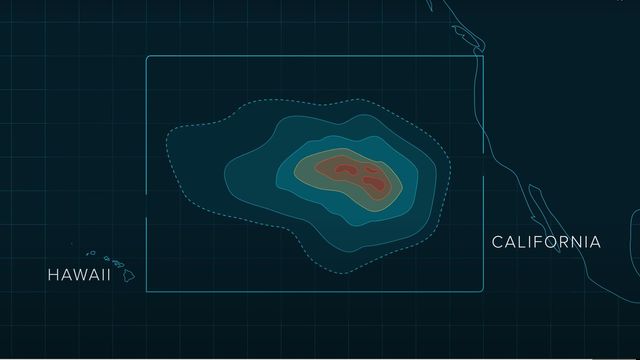
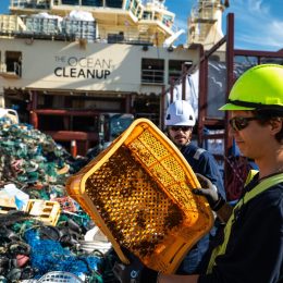
Between 2015 and 2018, we mapped the Great Pacific Garbage Patch (GPGP) and painted the first global picture of it. We estimate that up to 100,000 metric tons of floating plastic has accumulated around 1.6 million square kilometers in this area.
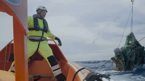
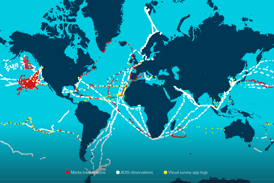
In 2025, sailors helped our Research team during another Pacific Expedition: we tagged GPS buoys to megaplastics found at sea, allowing us to track their movement, and mounted ADIS on boats to help identify plastic hotspots. Using maps that were derived from multiple current circulation models of the GPGP.
Besides our in-depth expeditions, we constantly monitor the GPGP. A seven-year study by the Head of Research proved that plastics are fragmenting much faster than expected, rising from 2.9kg per km2 to 14.2kg per km2, creating dangerous threats to the environment.
NUMERICAL MODELING
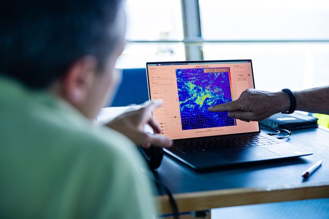
Numerical modeling is essential for pinpointing the current location of plastic accumulation hotspots in the ocean. With this information, we can actively steer our ocean cleanup system toward areas of high concentration, making the cleanup more efficient.
As part of this effort, in 2025, we’ve partnered with Amazon Web Services (AWS) to harness the power of artificial intelligence, machine learning, and cloud computing, accelerating our capacity to detect, predict, and extract plastic at scale.
MAPPING OF OTHER GYRES
The GPGP is the largest accumulation of floating plastic in the ocean – but it’s not the only gyre where floating plastic accumulates. Currently, there is limited research on the other gyres.
We aim to map these other gyres as we have for the GPGP, with expeditions across the North Atlantic, South Pacific and South Indian Oceans. Understanding these gyres and the varying dynamics of the accumulated plastic they contain is essential to developing solutions and strategies to clean the entire ocean.
Researching river plastics
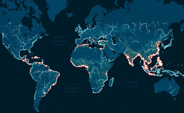
Rivers are the main route through which mismanaged plastic waste is transported from land to the ocean. Our researchers map these rivers and identify leading sources of plastic pollution to build and refine computational river-to-ocean emission models.
Smart River Survey
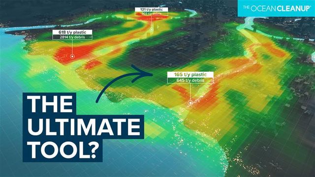
The Survey is a process which provides a comprehensive overview of riverine plastic pollution within a city and enables us to tailor solutions which fit individual contexts. It is one of the first processes we implement when in a new location. We use a range of technologies including drones, AI-enhanced remote-sensing cameras, GPS drifters, and global data registries. This is combined with research and information from our local partners, which contextualizes the pollution problems the city faces.
One of the results is an interactive map which provides decision-makers with crucial measurable metric related to river pollution. From this map we can visualize and interpret complex information with relative ease and identify the most impactful locations for a solution to be deployed.
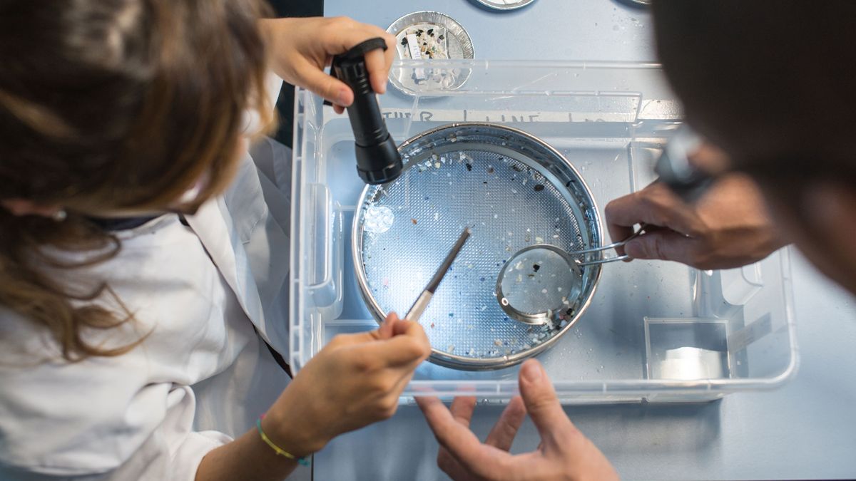
OBSERVATIONAL DATA
Our research team conducts field sampling to measure the amount of plastic emissions from rivers to the ocean and lab experiments to understand how plastic behaves under different conditions. This information allows us to continuously improve our modeling methodology and obtain a more accurate global mapping of sources of plastics in the ocean.
To accurately predict plastic emissions from rivers, we have started several multi-year monitoring campaigns across three continents. This data not only helps us identify the best place to deploy our Interceptors – it also informs governments in taking upstream mitigation measures and raising awareness of environmental issues impacting local communities.
COMPUTATIONAL MODELING
To understand how plastic emissions make their way into the ocean, our research team develops numerical models that study the transport and emission of plastics from rivers. Our research has identified 1000 rivers that emit nearly 80% of the world’s river plastic into the ocean. By targeting these rivers, we can drastically reduce the influx of plastic into the ocean.
Our research team is further refining this model by improving input data, accounting for multiple source scenarios, different land use, topography and seasonal variations.
Advanced plastic detection technology
Rapidly evolving technologies such as artificial intelligence and remote sensing technology allow us to automate data gathering on floating plastic accumulation. By allowing us to understand greater quantities of data, this technology accelerates our understanding of the problem and our development of solutions.
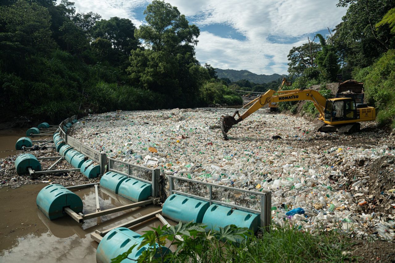
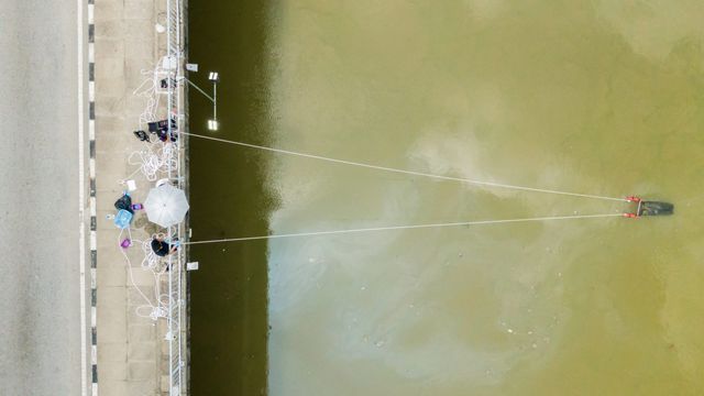
RIVER MONITORING SYSTEM
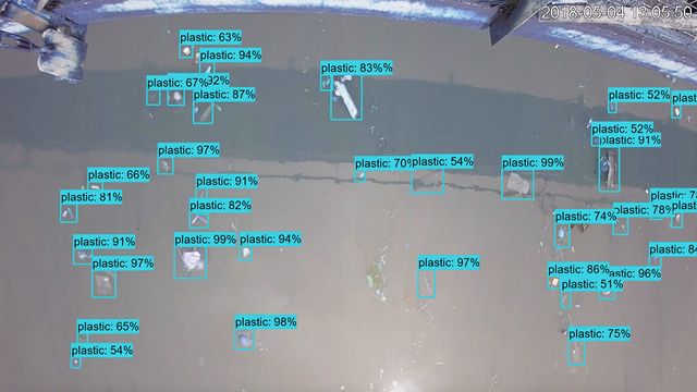
Our team places cameras on bridges as part of our River Monitoring System (RMS). These cameras capture images of plastic debris in rivers, with images used to train AI models to identify and categorize plastic pollution. Understanding how plastic emissions change due to geographical and seasonal variations lets us target cleanup efforts more efficiently. This monitoring also helps measure the effectiveness of preventive measures against plastic pollution.
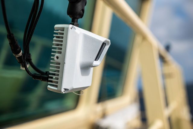
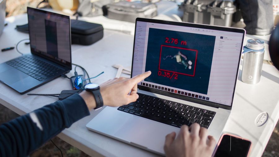
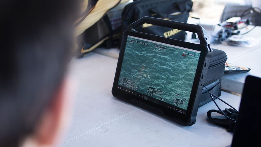
AUTOMATED DEBRIS IMAGING SYSTEM (ADIS)
Plastic in the global ocean is widely spread out, unevenly distributed, and constantly shifting: there may be dense levels of plastic in one area but not in another at any time. To succeed, our cleanup requires access to up-to-date information on where plastic is at any given moment.
Our innovative Automated Debris Imaging System (ADIS) monitors and maps the distribution of plastic debris in the oceans, pioneering in the field of ocean plastic detection. AI-powered cameras mounted on seafaring vessels collect surface imagery and analyze big data in real-time.
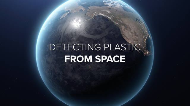
SATELLITE REMOTE SENSING
Ocean plastics are hard to detect, far away from land, and scattered over hundreds of thousands of square kilometers. River plastic emissions can also be difficult to quantify if rivers are inaccessible. Remote sensing of plastic litter has the potential to map hotspots of plastic pollution worldwide, helping us focus on the effective deployment of cleanup solutions.
Recently, The Ocean Cleanup has begun using satellite imagery in coastal waters to support impact reporting for our river projects worldwide. The aim is to provide clear visual evidence that our deployments and operations are restoring previously polluted areas and making a visible difference.
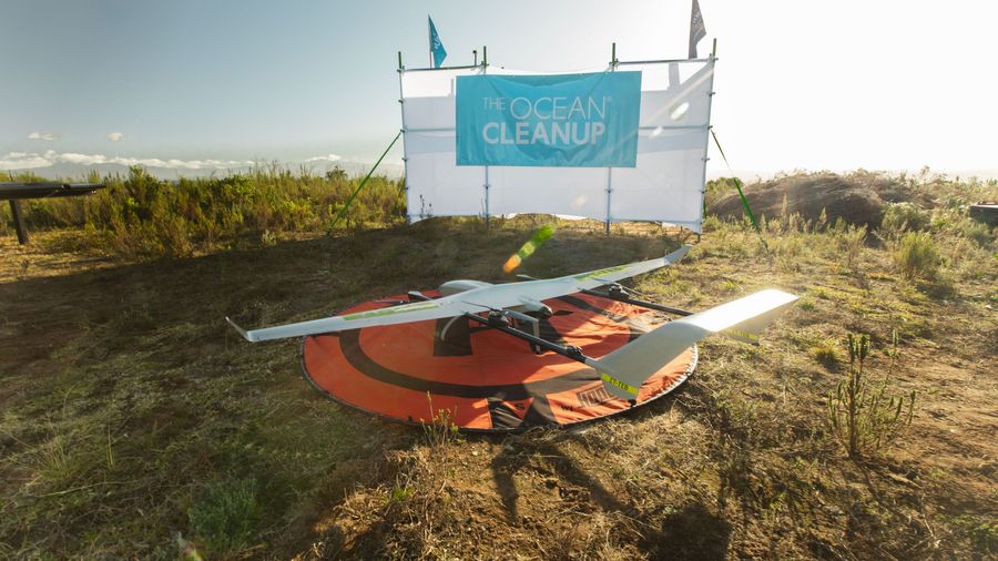
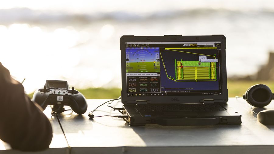
AERIAL DRONES
To help us identify plastic hotspot quicker in the Great Pacific Garbage Patch, We are developing aerial drones equipped with AI-powered cameras to help us identify plastic hotspots in the Great Pacific Garbage Patch quicker.
So far, we have conducted aerial drone tests in South Africa, these tests include the use of infrared sensors for nighttime detection, a promising step forward in improving 24/7 operational efficiency.

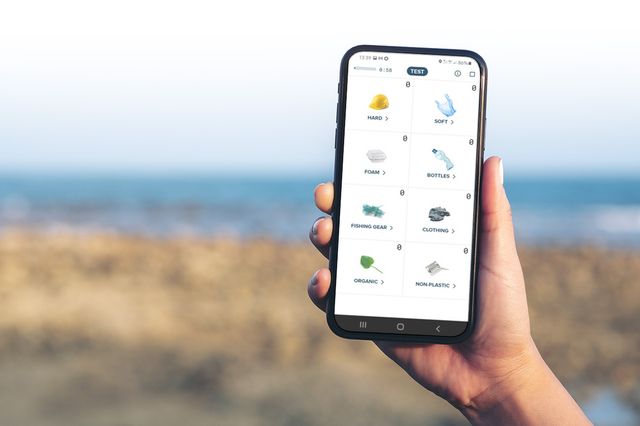
Become a citizen scientist
Join the largest cleanup in history by becoming a Citizen Scientist. You can help The Ocean Cleanup gather data on plastic in waterways around the world using our Ocean Cleanup Survey App. Data gathered are used to optimize our global cleanup strategy. All you need is a smartphone and a passion to work on this important environmental issue. Every data point counts!
Latest scientific publications
-
Plastic ingestion by North Pacific garbage patch fishes: highest occurrences and quantities in upper trophic pelagics
June 2026, article in a peer review,
Environmental Research Communications -
Three rivers to the test: Lessons for global plastic transport modelling
May 2026, article in a peer review,
Environmental Pollution
Academic partners


Join the cleanup
-

Support the project
Help us continue advancing the scientific knowledge of the plastic pollution problem and clean it up.
-

Join our crew
Contribute your skills, and build a cleaner future with us. We're always looking for dedicated and inventive minds to join our crew. You can also volunteer your time by becoming a citizen scientist.
-
Reach out
Get in touch if you have questions about our research or would like to get access to specific research data.